Now Reading: Lot Vision: How Smart Tracking and Home Planning Tools Are Changing Everyday Decisions
-
01
Lot Vision: How Smart Tracking and Home Planning Tools Are Changing Everyday Decisions
Lot Vision: How Smart Tracking and Home Planning Tools Are Changing Everyday Decisions

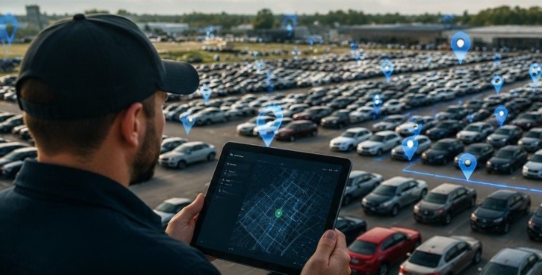
A vehicle can disappear inside a 500-acre auction facility within minutes, but lot vision technology can help staff find it with surprising accuracy. What once required walking through endless rows of cars or checking paper records is now handled through digital maps, wireless tracking, and real-time data.
The term lot vision can mean different things depending on the industry. In the automotive world, it refers mainly to Manheim’s vehicle location technology that helps dealers and auction teams locate inventory quickly. In home construction, it describes a visualization tool that helps homeowners place custom house designs on their actual land before building.
Both uses solve the same basic problem: understanding a physical space better before making decisions.
What Is Lot Vision and Why Is It Becoming More Important?
Large properties create a simple challenge: finding things quickly. Whether it is thousands of vehicles waiting for auction or a piece of land being prepared for a custom home, people need accurate information about space.
Lot vision technology combines digital mapping, location data, and visualization tools to make physical areas easier to understand. Instead of relying only on signs, memory, or manual measurements, users can interact with a digital version of the location.
For businesses, this means less wasted time and smoother operations. For homeowners, it means fewer surprises before construction begins.
The growth of these tools follows a larger trend toward digital transformation. The National Institute of Standards and Technology (NIST), a U.S. government agency, has highlighted how location-based technologies and digital systems improve efficiency across many industries.
You can learn more about technology standards and innovation research through the official NIST website.
How Does Manheim Lot Vision Help Auto Dealers Find Vehicles Faster?
The automotive auction industry handles enormous vehicle inventories. A dealer may purchase several cars during an auction event, but finding those vehicles afterward can become a time-consuming task without proper tracking.
Manheim’s version of lot vision uses wireless tracking devices connected to vehicles through methods such as the OBD port or attached equipment. These devices communicate location information, allowing users to view where a vehicle is positioned on a digital lot map.
Instead of searching row by row, authorized users can enter details like a Vehicle Identification Number (VIN) or work order number. The system then helps identify the vehicle’s approximate location.
This approach is especially useful for:
- Auto dealerships managing purchased inventory
- Transport companies moving vehicles between locations
- Auction employees organizing vehicle flow
- Inspection teams preparing cars for sale
The biggest advantage is time savings. A worker who previously spent significant time searching a massive auction property can locate vehicles much more efficiently.
What Features Make Vehicle Tracking Technology Useful?
Finding vehicles is only one part of the technology. Modern auction tracking systems often provide additional information that helps businesses make better decisions.
One valuable feature is vehicle condition monitoring. Some systems can collect diagnostic trouble codes (DTCs), allowing teams to identify possible mechanical issues before transportation or resale.
For dealers, this information can improve planning. A vehicle showing warning signals may need inspection before delivery, while another vehicle may be ready for immediate movement.
The combination of location and vehicle data creates a clearer picture of inventory management. Businesses are not just finding cars; they are understanding what is happening with their assets.
How Does Lot Vision Work for Custom Home Planning?
The home-building meaning of lot vision is completely different but equally practical.
When building a custom home, choosing the perfect house design is only one part of the process. The land itself creates important limitations. Property shape, driveway placement, sunlight direction, slopes, and surrounding features can affect the final design.
Schumacher Homes uses a lot visualization feature that allows homeowners to place house plans over satellite views of their actual property.
Users can typically enter information such as:
- Property address
- Parcel details
- Land boundaries
The digital view helps homeowners imagine how their future home may fit on the lot before construction starts.
This can prevent common planning mistakes, such as choosing a design that does not work well with the available space.
Why Does Digital Lot Planning Matter Before Building a Home?
Many homeowners focus heavily on floor plans and interior design, but land placement can be just as important.
A house that looks perfect on paper may need adjustments once builders consider the actual property. A digital lot visualization tool gives families a better understanding of:
- Home orientation
- Available outdoor space
- Driveway positioning
- Yard size
- Relationship with neighboring properties
The U.S. Department of Housing and Urban Development (HUD) emphasizes the importance of proper planning and responsible construction practices when developing residential properties.
More housing information and resources are available at: https://www.hud.gov/
A visualization tool does not replace professional surveying or engineering, but it helps homeowners ask better questions before investing money.
How Can You Use Lot Vision Tools More Effectively?
Whether you are tracking vehicles or planning a home, the best results come from using accurate information.
For vehicle tracking, follow this simple process:
First, confirm the correct vehicle details. A VIN or work order number helps avoid searching for the wrong asset.
Next, access the digital tracking platform provided by the auction facility. Review the mapped location and confirm the vehicle status before sending staff or transportation teams.
Finally, verify the vehicle physically after locating it. Digital systems improve accuracy, but real-world conditions can change because of vehicle movement or operational updates.
For home planning, the process is slightly different:
Start by confirming your property information, including the address and parcel details.
Then compare possible home placements on the digital map. Look at driveway access, outdoor areas, and how the home fits within the property.
Before final decisions, work with professionals such as builders, architects, or surveyors. Visualization is a planning tool, not a replacement for technical approval.
What Are the Limitations of Lot Vision Technology?
Although these tools are useful, they are not perfect. Vehicle tracking depends on properly installed devices, system availability, and updated location information. Large facilities may still experience operational changes that require human confirmation.
Home visualization tools also have limits. Satellite images may not show every detail, such as underground conditions, exact elevations, drainage issues, or zoning restrictions.
Another common misunderstanding is assuming a digital model guarantees a final result. In reality, professional inspections and approvals remain necessary.
The smartest approach is to use these tools as decision-support systems rather than complete replacements for expert advice.
Frequently Asked Questions About Lot Vision
1. What is lot vision used for?
Lot vision is used for tracking vehicles in large auction facilities and visualizing home designs on specific land parcels. The purpose is improving location awareness and planning.
2. Is Lot Vision only for car auctions?
No. The term can also refer to home visualization tools that help homeowners understand how a custom house design fits on their property.
3. Can Lot Vision replace a property survey?
No. It helps with planning but does not replace professional surveying, engineering reviews, or construction approvals.
4. How accurate is vehicle tracking technology?
Accuracy depends on the system and conditions. Manheim’s tracking technology is designed to provide detailed vehicle location information within auction environments.
Final Thoughts: Better Decisions Start With Seeing the Bigger Picture
The real value of lot vision technology is not just finding a vehicle or placing a house design on a map. It is about turning confusing physical spaces into understandable digital information.
For dealerships, it reduces wasted time and improves inventory management. For homeowners, it creates confidence before making one of life’s biggest investments.
The next time you think about a crowded auction yard or an empty piece of land, remember this: better visibility often leads to better decisions.